
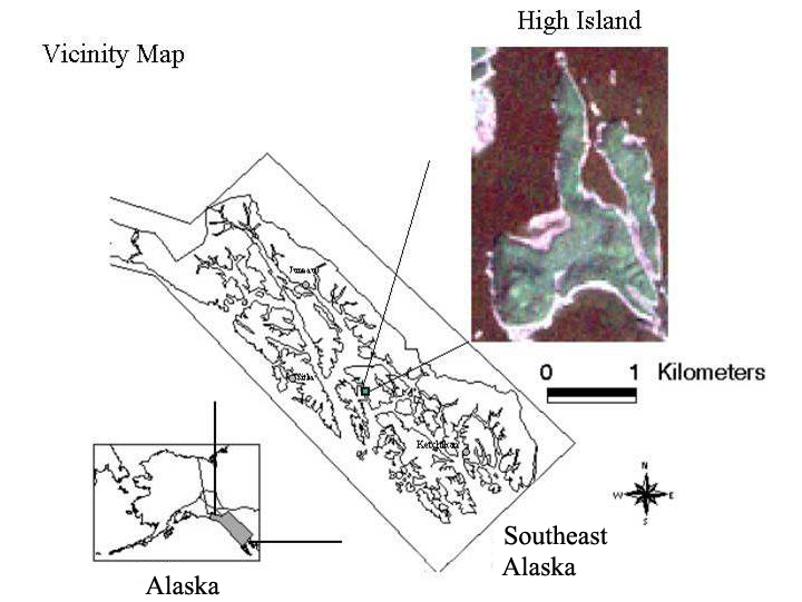
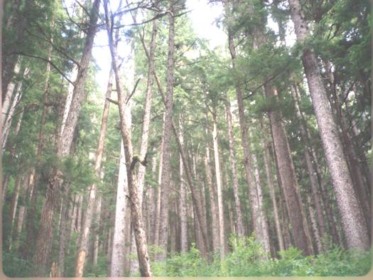
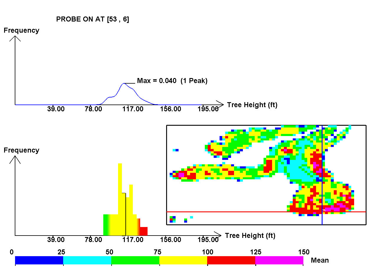
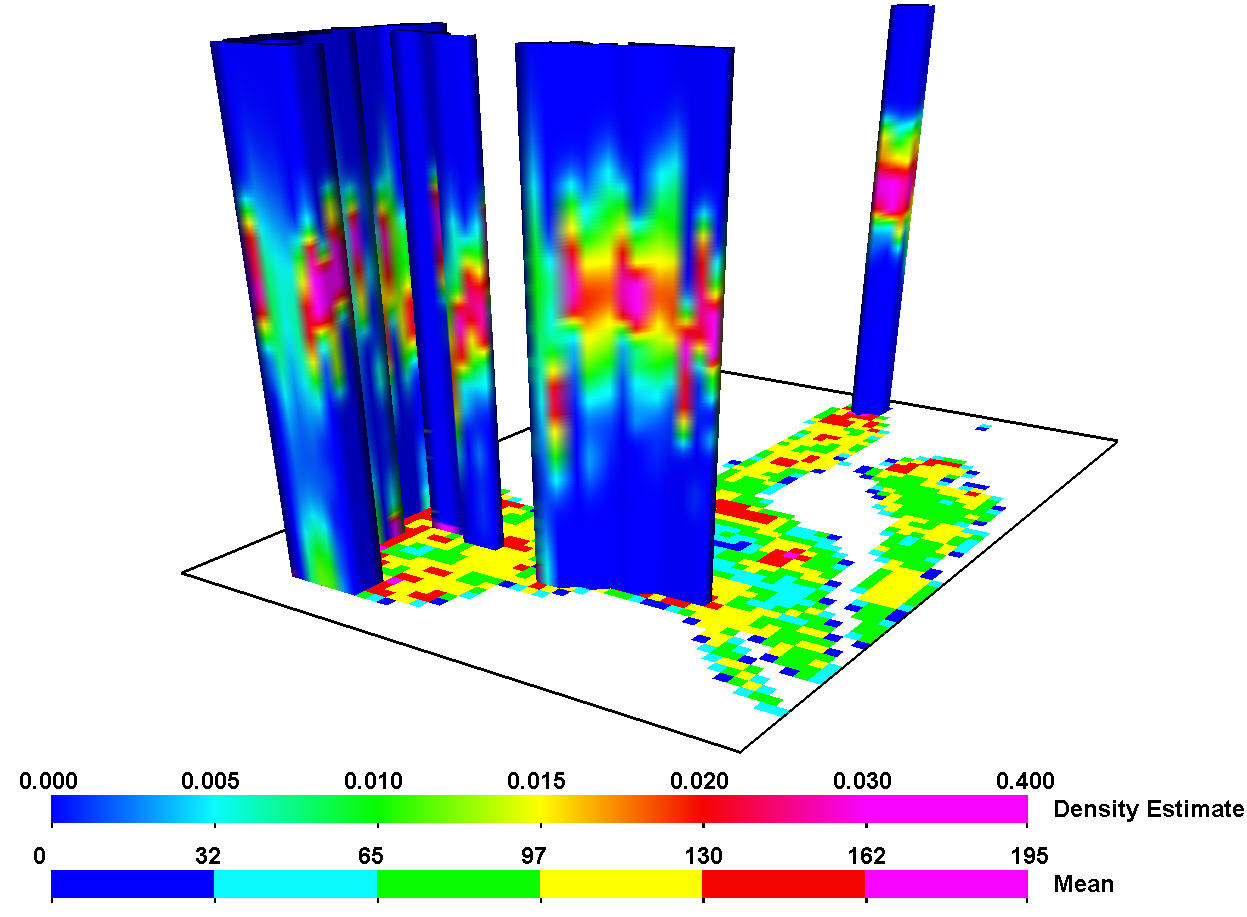
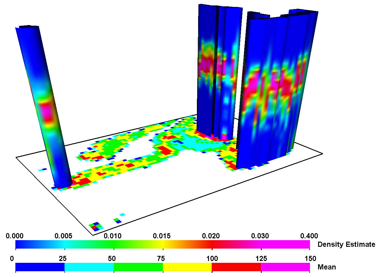
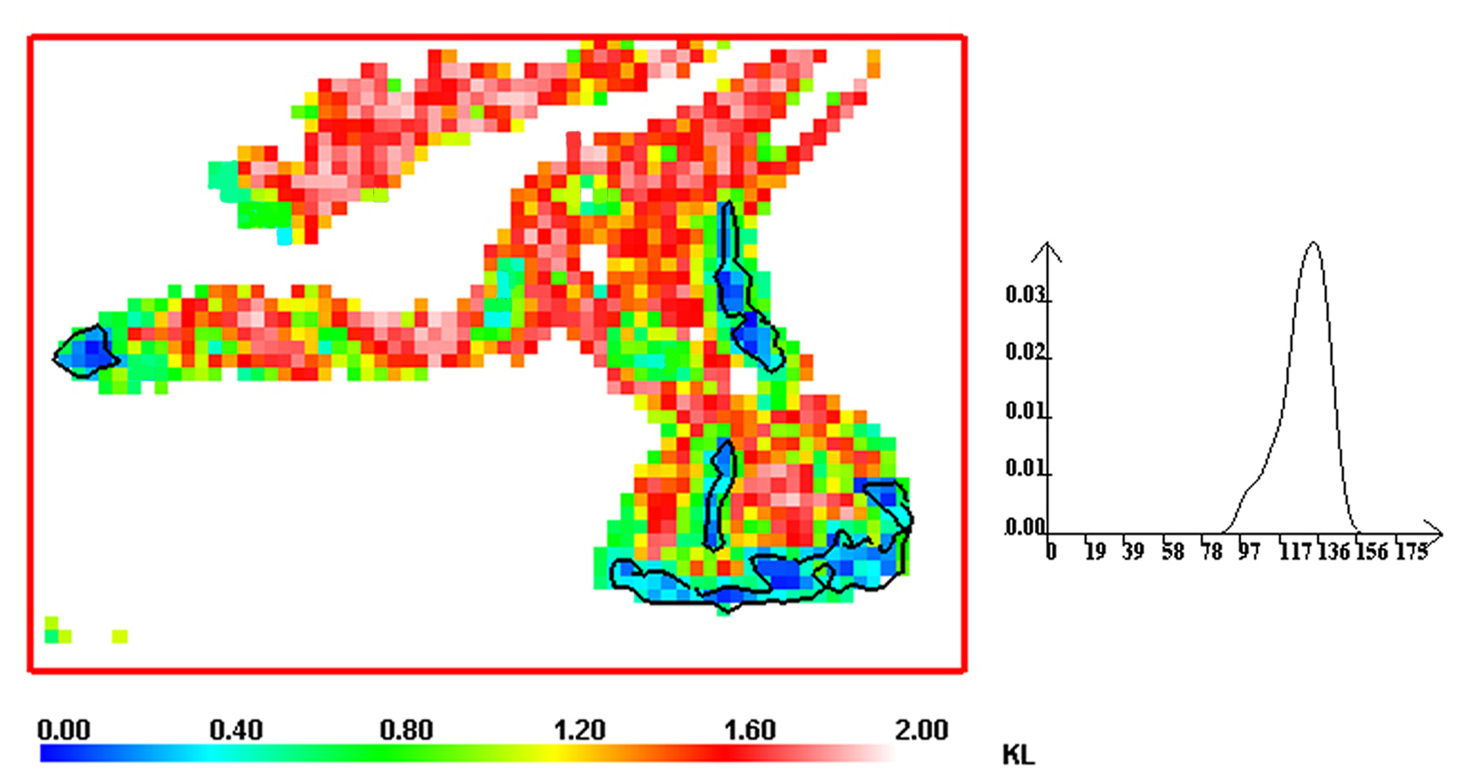
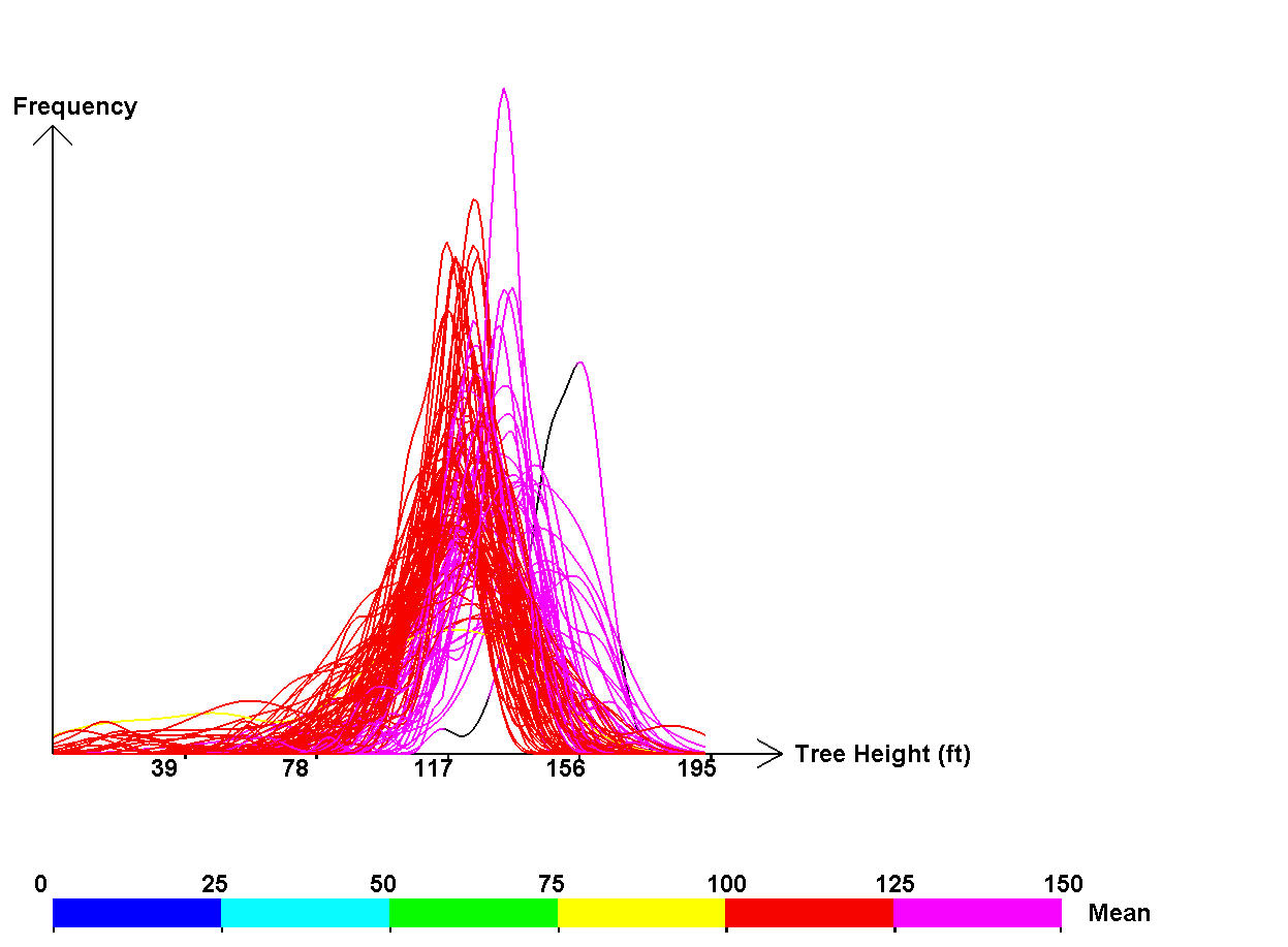
Spatially distributed probability density functions (pdfs) are becoming relevant to the Earth scientists and ecologists because of stochastic models and new sensors that provide numerous realizations or data points per unit area. One source of these data is from multi-return airborne lidar, a type of laser that records multiple returns for each pulse of light sent towards the ground. Data from multi-return lidar is a vital tool in helping us understand the structure of forest canopies over large extents. This paper suggests visualization tools to allow scientists to rapidly explore, interpret and discover characteristic distributions within the entire spatial field. The major contribution ot this work is a paradigm shift which allows ecologists to think of and analyze their data in terms of full distributi ons, not just summary statistics. Information on the modality and shape of the distribution previously not possible. The tools allow the scientists to depart from traditional parametric statistical analyses and to associate multimodal distribution characteristics to forest structures. Examples are given using data from High Island, southeast Alaska.
|
|
|
|
|
|
|
|
|
|
|